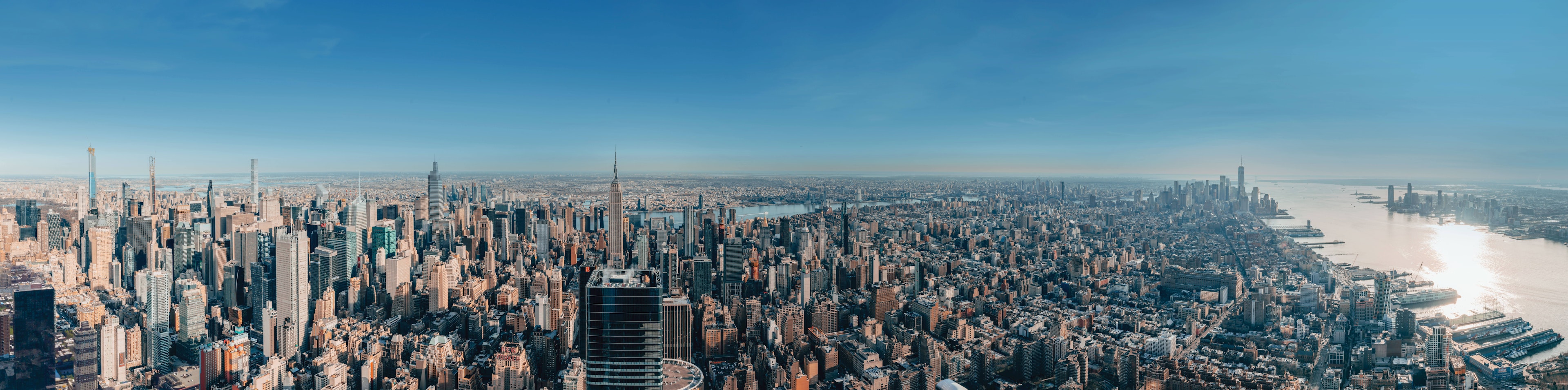
Data-driven Webcams for Smart Cities
How Panomax Webcams support Smart Cities


Clear planning foundations: cities are constantly evolving. Our Smart City webcams make these changes visible, providing clear images of key locations at all times. They help cities monitor developments, interpret trends, and plan proactively.
Interactive communication: by combining live footage with interactive layers, a new form of urban communication emerges. Infrastructure, public spaces, and mobility offerings become visible, understandable, and tangible—for both decision-makers and residents.
Centralized hub: Panomax connects existing city data sources and visualizes them directly within the live image. Information is displayed where it matters most. With Panomax webcams, everything is in one place, clearly structured, and always accessible.
Smart City data made visible
Important webcam features for Smart Cities

DATA DISPLAY - API
Panomax is able to gather data from multiple sources in your city, and embed it directly into the live view. The centralized information is easily accessible, and logical to understand.
INTEGRATED WEATHER DATA
Panomax integrates live meteorological information directly into the panoramic view of your city - linking each image with real conditions at the time it was captured. See more!
CITY DEVELOPMENT ANALYSIS
See your location evolve through time. Panomax helps you compare your location over days, years and decades. Discover changes in the urban landscape, seasonal differences, and shifting activity patterns at a glance. See more!
Smart City webcams from Panomax projects

All of your city’s data in one place
Increase visibility and showcase your location or project with personalized branding and promotional opportunities.






Testimonials
Hear what our clients have to say
FAQ
FAQ for Smart Cities
Panomax webcams offer cities many ways to present their sights, infrastructure, and urban spaces digitally. Thanks to the high image resolution, even distant details remain clearly visible. With the interactive Panomax software, points of interest (POIs) can be marked directly in the panoramic image and linked to further information (e.g., opening hours, sights, or infrastructure).
In addition, the live panoramic images are supplemented with current weather data, making it possible to see how the weather changes over time. The permanent image archive automatically documents the evolution of the cityscape. This makes Panomax webcams suitable for both digital presentation and the long-term documentation of urban change.
With the interactive Panomax software, live panoramic images can be linked directly to current information. For this purpose, so-called points of interest (POIs) or hotspots can be integrated into the panoramic image, providing information on opening hours, sights, infrastructure, or events. The content can be linked to further websites. This gives visitors and residents a clear overview and lets them explore what the city has to offer right in the panoramic image.
Operating public webcams in cities requires compliance with the applicable national data protection regulations and, within the EU, the General Data Protection Regulation (GDPR) in particular. Key factors include the purpose of the camera, whether people are identifiable, how the images are published, and how they are stored and further processed.
The Panomax software supports data-protection-compliant operation through the automatic pixelation of people and license plates. In addition, sensitive areas (e.g., playgrounds or private property) can be specifically blurred out.
With Panomax webcams, cities can visually document their development over longer periods of time. All panoramic images are stored in a digital image archive, making it possible to compare historical shots with current images. For example, you can trace changes to buildings, public squares, or neighborhoods. This visual comparison can be used for PR, communication, and the presentation of major urban projects.
The investment cost of a professional webcam for cities and municipalities depends on the chosen camera model, the technical requirements, and the conditions at the planned location.
Panomax is happy to help you find the right camera location and the right camera model. Contact us for a non-binding consultation and a tailored quote for your project.